Scottsdale’s housing market moves fast, and buyers scroll even faster. A listing photo set that looks like every other set on the MLS gets swiped past in under two seconds. That’s the reality agents are working with right now, and it’s why real estate drone aerial photography in Scottsdale has gone from a “nice extra” to something sellers actively ask for by name.
I’ve spent enough time on Scottsdale rooftops and hovering a drone over Desert Mountain fairways to know the difference between a photo set that gets a listing noticed and one that just fills out an MLS requirement. This guide walks through what real estate drone aerial photography in Scottsdale AZ actually adds to a Scottsdale listing, what it costs, how the regulations work, and how to tell a professional operation from someone who bought a drone last weekend.
Why Aerial Photography Matters So Much in Scottsdale Specifically
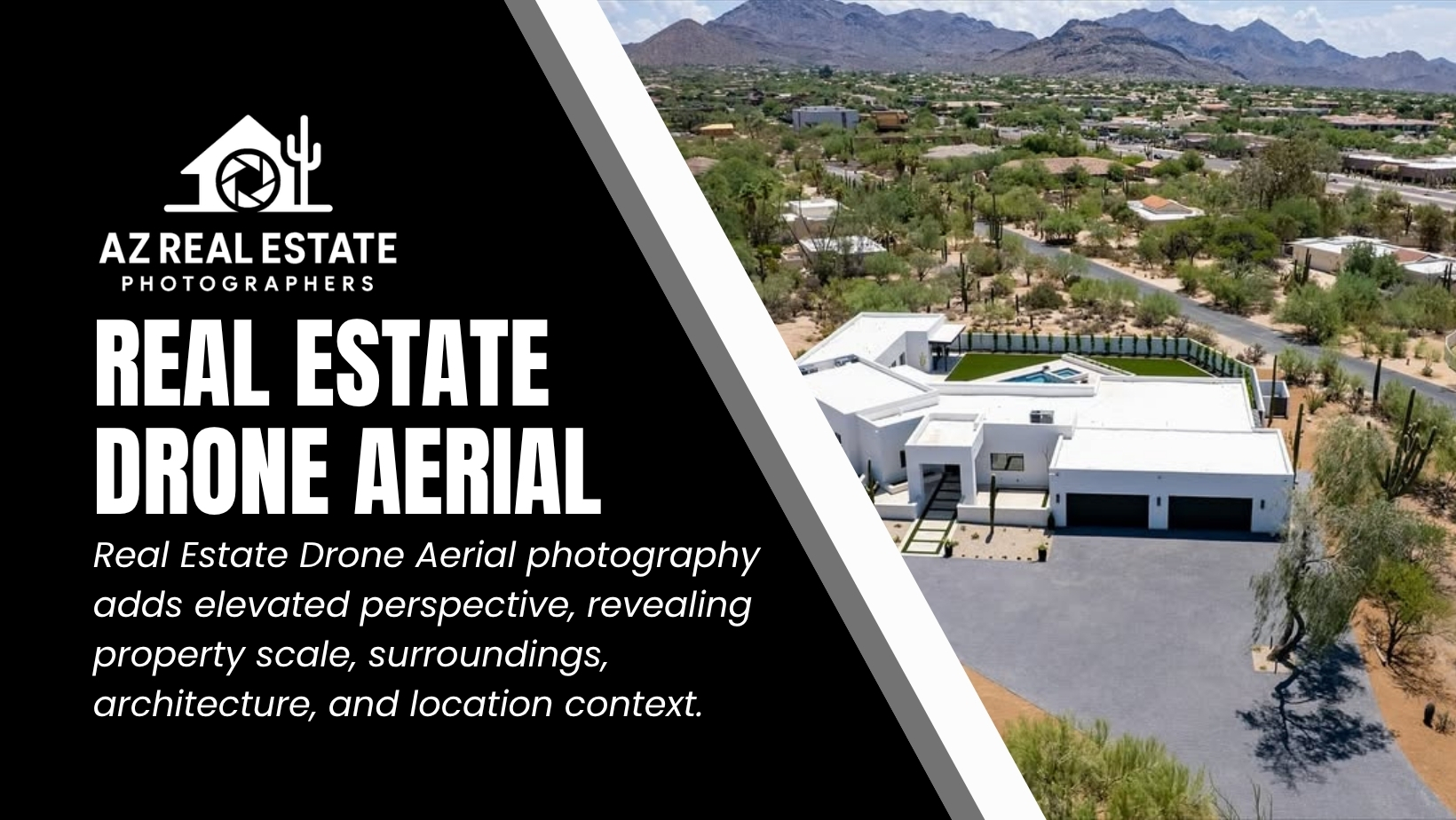
Scottsdale isn’t a flat suburban grid. It’s a city built around golf courses, mountain preserves, canal frontage, and gated communities where the lot itself is half the selling point. A ground-level photo of a home in Silverleaf or Troon North tells a buyer almost nothing about what makes that property worth the asking price.
Drone photography solves a problem that ground photography physically can’t. It shows:
- Proximity to the McDowell Sonoran Preserve or a specific golf course hole
- Lot shape, setbacks, and how much usable outdoor space actually exists
- Pool placement relative to sun exposure and neighboring homes
- Mountain views that only reveal themselves from 60 to 150 feet up
- The full footprint of larger estate properties that a wide-angle lens on the ground simply cannot capture
For a $450,000 townhome near Old Town, a couple of aerial shots might round out the gallery. For a $3M custom build in DC Ranch, aerial photography and video are often what convinces an out-of-state buyer to book a showing at all. Buyers relocating from California, Washington, or Illinois are researching Scottsdale listings from a screen hundreds of miles away, and aerial footage is frequently the closest thing they get to an in-person walk of the property before they fly in.
What’s Actually Included in a Professional Drone Photography Package
Not every drone photo service delivers the same thing, and this is where a lot of sellers get confused when comparing quotes. A proper aerial package for a Scottsdale listing typically includes some combination of the following.
Aerial Still Photography
These are the shots that go straight into the MLS gallery and Zillow listing. A skilled pilot will typically capture:
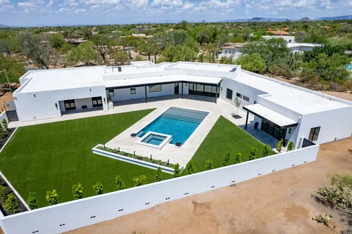
- A hero shot from a 45-degree angle showing the home, lot, and immediate surroundings
- A straight-down or high-angle shot showing lot boundaries and layout
- Directional shots highlighting mountain views, golf course frontage, or water features
- Neighborhood context shots for buyers relocating from out of state
Aerial Video and Flyover Reels
Short vertical video clips built for Instagram Reels, TikTok, and YouTube Shorts have become standard in Scottsdale listing marketing over the past couple of years. A 15 to 30 second flyover that starts on the street and rises to reveal the property performs noticeably better on social media than a static photo carousel, particularly for listings above the $1M mark.
Twilight Aerial Photography
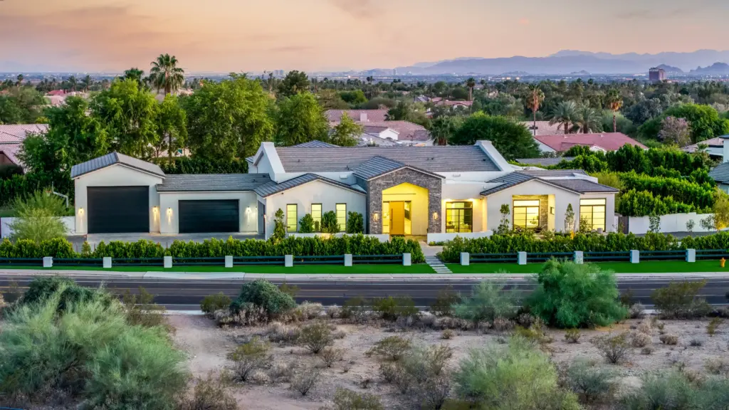
Twilight drone shots, taken during the 20 to 30 minute golden window right after sunset, are one of the most requested add-ons for Scottsdale listings. Interior lights glowing against a purple-orange desert sky make a property look considerably more valuable than the same home shot at noon. Given how many days a year Scottsdale offers clean sunsets, twilight aerial work is worth the extra scheduling effort.
3D Lot Mapping and Boundary Overlays
For larger parcels, some photography teams now offer aerial mapping that overlays approximate lot lines onto the image. This is particularly useful for horse properties in North Scottsdale or custom-build lots where buyers want a clear sense of buildable space.
FAA Rules and Licensing: Why This Matters More Than Sellers Realize
This is the part of the process most homeowners never think about until something goes wrong, and it’s genuinely important.
Commercial drone operation in the United States, including any drone flight done to help sell a property, falls under FAA Part 107. That means the pilot flying over a Scottsdale home for marketing purposes is legally required to hold a Part 107 Remote Pilot Certificate. This isn’t a technicality. Flying without one is a federal violation, and it also usually means the operator carries no liability insurance for the flight.
A few things a licensed, professional operator will always account for that an unlicensed hobbyist often won’t:
- Airspace restrictions. Parts of Scottsdale sit close to Scottsdale Airport (SDL) controlled airspace, which requires specific authorization through the FAA’s LAANC system before a drone can legally take off nearby.
- Insurance. Reputable aerial photography businesses carry commercial liability coverage, which matters if a drone were to malfunction near a home, pool, or neighboring property.
- Privacy and neighbor considerations. Experienced pilots know how to frame shots that highlight the subject property without capturing unnecessary footage of neighboring backyards.
- Weather judgment. Scottsdale wind patterns, especially near South Mountain and in open desert areas, can shift quickly. A licensed operator knows when to reschedule rather than fly in unsafe conditions.
If an agent is comparing two quotes and one is noticeably cheaper, it’s worth simply asking to see the Part 107 certificate number. It takes ten seconds to verify.
What Drone Real Estate Photography Costs in Scottsdale
Pricing varies based on property size, package scope, and whether video and twilight shots are included, but here’s a realistic breakdown of what Scottsdale sellers and agents can generally expect. Prices climb for larger estate lots, gated community access coordination, and same-day turnaround requests. Most professional photographers in the Scottsdale market deliver edited images within 24 to 48 hours, which matters when a listing is scheduled to go live on a specific date.
How to Choose the Right Drone Photographer for Your Listing
A drone is a tool, not a skill set. The difference between an average result and an exceptional one comes down to the pilot’s eye for composition and their understanding of what actually sells a Scottsdale property. Here’s what to check before booking.
- Ask for a portfolio of Scottsdale-specific work. Aerial photography for a desert property looks completely different from aerial work in a green, tree-covered market. Look for a portfolio that shows they understand how to shoot against desert terrain, xeriscaping, and strong Arizona light.
- Confirm Part 107 certification and insurance. Covered above, but it bears repeating. This protects the seller, the agent, and the brokerage.
- Ask how they handle HOA and gated community access. Many North Scottsdale communities require advance notice or gate codes for outside vendors. A photographer who’s worked the area before will already know the process.
- Check turnaround time. In a market where listings often go live within days of the photo shoot, a 24-to 48-hour delivery window should be the standard, not the exception.
- Look at how they edit for Arizona light. Scottsdale’s harsh midday sun can blow out highlights and create flat, washed-out aerial images. Skilled editors know how to balance exposure so the desert landscape still reads with texture and color rather than looking overexposed.
Aerial Photography by Property Type
Not every Scottsdale property needs the same aerial approach, and a good photographer will adjust the shot list based on what’s being sold.
Golf course and resort community homes (Grayhawk, Troon, McCormick Ranch) benefit most from angled shots that clearly show fairway or green frontage, since course proximity is often a primary selling point.
Mountain view estates (Silverleaf, DC Ranch, Desert Mountain) do best with higher-altitude shots that capture the McDowell Mountains or Camelback Mountain in the background, giving buyers a sense of the view they’d actually wake up to.
Old Town and central Scottsdale condos or townhomes typically need lower-altitude aerial shots focused on walkability, proximity to downtown, and rooftop deck space rather than sprawling lot views.
Equestrian and acreage properties in north Scottsdale rely heavily on aerial mapping to show arena space, barn layout, and total usable acreage, details that are almost impossible to convey from the ground.
Common Mistakes Sellers and Agents Make with Drone Photography
A few patterns show up again and again with Scottsdale listings that underperform despite having drone photos included.
- Flying at the wrong time of day. Midday shots in Scottsdale often wash out under direct sun. Morning and golden hour flights produce far better color and shadow definition.
- Too many similar angles. A gallery with six nearly identical aerial shots adds nothing. Two or three well-chosen angles beat a dozen redundant ones.
- Skipping video entirely. Static photos still matter, but listings with even a short aerial video clip tend to get more engagement on social platforms and syndicated listing sites.
- Ignoring the neighborhood context shot. Buyers relocating to Scottsdale from out of state often care as much about proximity to amenities as they do about the home itself. A wider aerial shot showing nearby trails, golf, or shopping can close that gap.
- Hiring based on price alone. The cheapest quote sometimes reflects an unlicensed operator with no insurance and inconsistent editing quality, which can end up costing more in the long run through delayed listings or liability exposure.
Conclusion
Aerial photography has stopped being an optional upgrade for Scottsdale listings and has become part of how serious agents present serious properties. It’s not about flashy footage for its own sake. It’s about giving a buyer, especially one who’s never set foot in Arizona, an honest and compelling sense of what the property and the surrounding land actually offer. When it’s done by a licensed, experienced pilot who understands Scottsdale’s terrain, light, and communities, it consistently makes the difference between a listing that sits and one that moves.
FAQ’s
How much does drone photography cost for a Scottsdale real estate listing?
Most Scottsdale drone photography packages range from $125 for basic aerial stills to $700 or more for a full package with video, twilight shots, and lot mapping. Pricing depends on property size and scope.
Do real estate drone photographers need a license in Arizona?
Yes. Any commercial drone flight, including real estate marketing, requires an FAA Part 107 Remote Pilot Certificate. Flying without one is a federal violation and typically means no liability insurance is in place.
How long does it take to get drone photos back after a shoot?
Most professional Scottsdale photographers deliver edited aerial photos within 24 to 48 hours. Rush delivery is sometimes available for an added fee if the listing needs to go live quickly.
Is drone photography worth it for smaller Scottsdale homes and condos?
It can be, especially for showing walkability, rooftop space, or proximity to Old Town. Aerial photography adds the most value for larger lots, view properties, and golf course or gated communities.
What’s the best time of day for real estate drone photography in Scottsdale?
Early morning or golden hour, roughly an hour before sunset, produces the best light and color. Twilight shots taken right after sunset are especially popular for luxury listings.
Can drones fly anywhere in Scottsdale for real estate photos?
Not always. Areas near Scottsdale Airport fall under controlled airspace and require FAA authorization through LAANC before flying. Licensed pilots know how to secure this clearance in advance.