
Scroll through any hot Phoenix neighborhood on the MLS, and you’ll notice a pattern fast: the listings that sell in days, not weeks, almost always open with an aerial shot. Real estate drone aerial photography in Phoenix, AZ has moved from “nice extra” to near-standard practice, especially for properties with pools, mountain views, large lots, or proximity to golf courses and desert preserves – all things ground-level photography simply can’t convey.
But not every drone photo is created equal. Bad lighting, shaky footage, or an unlicensed operator can do more harm than good to a listing’s first impression. This guide walks through exactly what makes aerial photography work in the Phoenix market, what it costs, what the FAA actually requires, and how to evaluate a drone photographer before you hand them your listing.
Why Aerial Photography Matters More in Phoenix Than Almost Anywhere Else
Phoenix’s housing stock has a few characteristics that make aerial imagery unusually valuable compared to other U.S. markets:
- Large lot sizes in suburbs like Ahwatukee, Anthem, and Fountain Hills are hard to communicate from the ground.
- Mountain and desert backdrops (Camelback, South Mountain, the McDowells) photograph dramatically better from above.
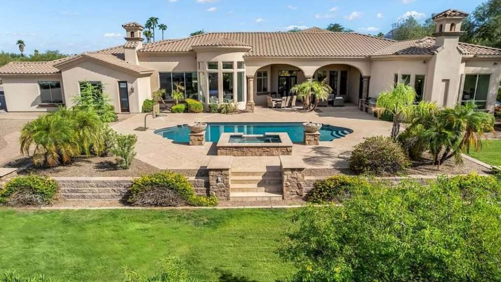
- Backyard pools and outdoor living spaces, which are the top-selling feature in most Valley listings, only make sense visually from an elevated angle.
- Master-planned communities benefit from aerials that show proximity to parks, greenbelts, and amenities.
- New construction and land listings rely almost entirely on aerial context since there’s often no finished structure yet.
In a market where buyers are frequently relocating from out of state and shopping listings online before ever stepping foot in Arizona, aerial photography does a lot of the persuading that an in-person showing would normally do.
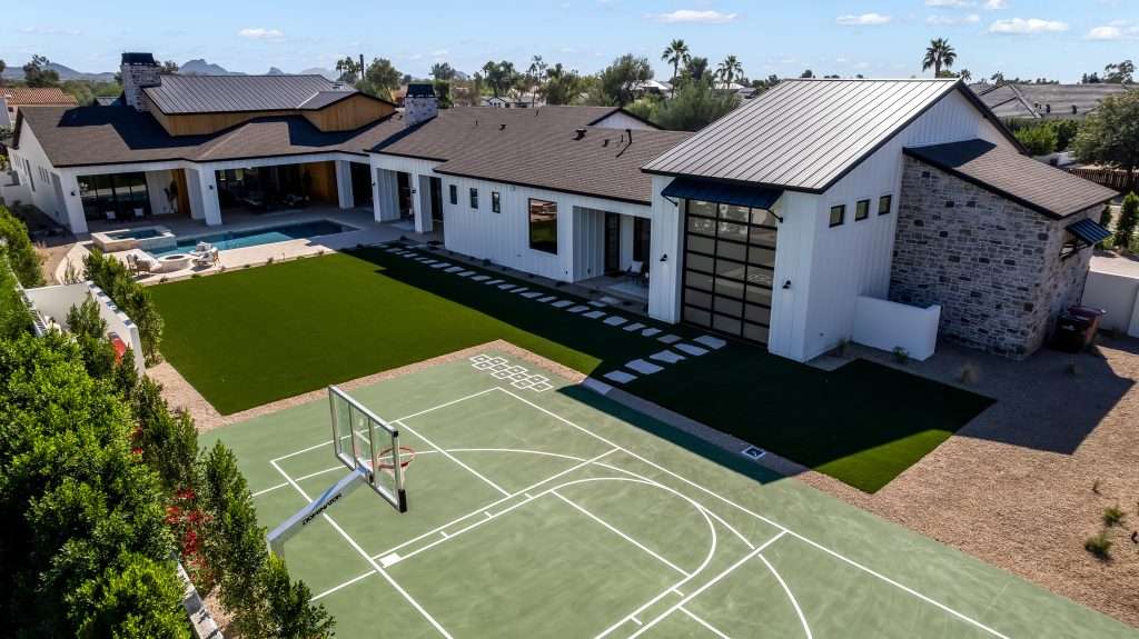
What’s Actually Included in a Professional Drone Aerial Shoot
A proper shoot is more structured than most sellers expect. Here’s what a typical Phoenix drone session covers.
Most reputable providers bundle drone work with ground photography, video walkthroughs, or 3D tours, since a single site visit can cover everything a listing needs. Booking these together also tends to be more cost-effective than ordering aerials as a standalone add-on later.
FAA Rules Every Phoenix Agent Should Understand Before Hiring a Drone Pilot
This is the part almost no competing page explains, and it’s the single biggest risk factor when hiring the wrong operator.
Any commercial drone flight in the U.S., including real estate photography, falls under the FAA’s Part 107 rule. That means:
- The pilot must hold a Remote Pilot Certificate, not just a hobbyist registration.
- The drone must be registered with the FAA if it weighs more than 0.55 lbs.
- Flights near Phoenix Sky Harbor International Airport, Scottsdale Airport, and other controlled airspace require FAA airspace authorization through the LAANC system before takeoff.
- Flying over people, at night, or beyond visual line of sight requires additional waivers.
- Operators should carry commercial liability insurance, since a licensed hobbyist policy typically won’t cover property damage during a paid shoot.
Some parts of the Phoenix metro, especially near Sky Harbor, Deer Valley Airport, and Falcon Field, sit inside controlled airspace where flights need pre-authorization. A properly licensed operator handles this automatically. An unlicensed one either skips it (a legal liability for the homeowner and agent, too) or can’t legally fly the area at all.
Before booking, it’s reasonable to simply ask: “Can you confirm your Part 107 certificate number and that you carry liability insurance?” A legitimate operator will answer without hesitation.
Best Times to Shoot Aerial Photos in the Phoenix Area
Timing affects the outcome of a drone shoot more in Phoenix than in most other markets, mainly because of how intense and directional the desert sun gets.
- Early morning (30-60 minutes after sunrise): Softer light, cooler temperatures for equipment, less shadow harshness on the roofline.
- Golden hour before sunset: The most requested time slot, producing warm tones that flatter desert landscaping and stucco exteriors.
- Twilight aerials: Shot roughly 15-20 minutes after sunset, when the sky still holds color and interior/exterior lights are on. These consistently perform well for luxury listings and pool homes.
- Midday (generally avoided): Harsh overhead light flattens detail and creates strong shadows, particularly tough on desert landscaping and red-tile roofs common throughout the Valley.
- Monsoon season (July-September): Wind and dust require flexible rescheduling; a professional operator will build weather contingency into your booking rather than flying in unsafe conditions.
How Much Does Real Estate Drone Aerial Photography Cost in Phoenix?
Pricing varies by property size, add-ons, and whether drone work is bundled with ground photography, but here’s a realistic range based on typical Valley market rates.
Luxury properties, large acreage, and commercial listings typically run higher due to added flight time and post-processing. Land listings without structures often need aerials as the primary marketing asset, which changes the pricing structure entirely.
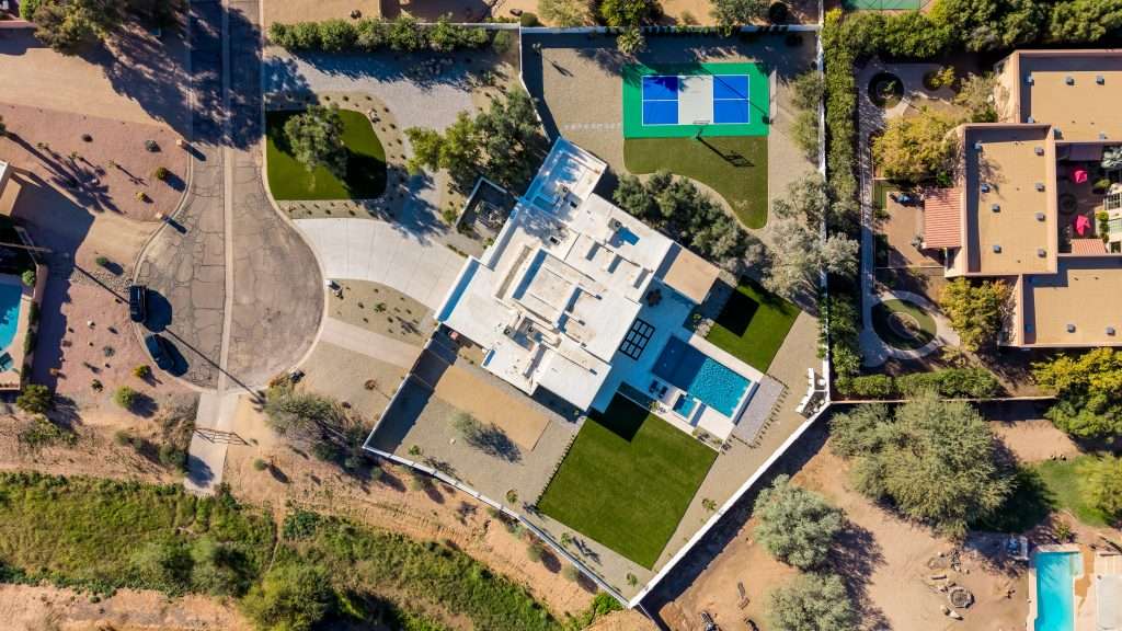
Drone Stills vs. Drone Video: Which Does Your Listing Need?
This is a common point of confusion for agents booking their first aerial shoot.
Drone stills work best for:
- MLS listing photo slots
- Print flyers and postcards
- Zillow/Redfin hero images
- Showing lot lines and property boundaries
Drone video works best for:
- Instagram Reels and TikTok listing promos
- YouTube property tours
- Luxury listing “cinematic” marketing
- Showing neighborhood context and proximity to amenities
Most agents marketing anything above the median Phoenix home price now request both, since social media has become a primary driver of buyer inquiries, and video consistently outperforms static images in engagement on those platforms.
Questions to Ask Before Booking a Drone Photographer in Phoenix
A quick pre-booking checklist protects both the agent and the seller:
- Are you FAA Part 107 certified, and can you provide your certificate number?
- Do you carry commercial liability insurance?
- Have you flown in [specific neighborhood/HOA] before, and are you aware of any local restrictions?
- What’s your typical turnaround time for edited images and video?
- Do you have a weather/rescheduling policy for monsoon season or high wind days?
- Can I see recent Phoenix-area aerial samples, not just a generic portfolio?
Any hesitation on questions 1-2 is a legitimate reason to keep looking.
HOA and Neighborhood Considerations in the Valley
Several master-planned Phoenix-area communities, particularly gated ones in Scottsdale, Paradise Valley, and parts of Chandler, have specific rules or expectations around drone flights over private property. While FAA airspace rules govern where flight is legal, HOA guidelines can still affect scheduling and neighbor relations. A seasoned local operator typically knows which communities require advance notice and handles that communication proactively, which is one more reason local experience matters more than it might seem on paper.
Conclusion
Real estate drone aerial photography in Phoenix, AZ isn’t just a visual upgrade anymore; it’s become part of how serious listings compete in a market full of relocating buyers who shop online first. The difference between a listing that gets scrolled past and one that gets an inquiry often comes down to whether the aerial shots were taken by someone who understands FAA compliance, desert lighting, and the specific geography of the Valley.
Before booking, ask the right questions, understand what’s actually included in a shoot, and time the session around Phoenix’s light and weather patterns rather than whatever slot happens to be open. Done right, aerial photography earns its cost back many times over in faster showings and stronger offers.
FAQ
How much does drone photography cost for a real estate listing in Phoenix?
Standalone drone stills typically run $125-$250, while a bundled photo-and-video aerial package ranges from $250-$450. Luxury homes, large acreage, and commercial properties usually cost more due to added flight time and editing.
Do drone photographers need a license to shoot real estate in Arizona?
Yes. Any paid drone flight, including real estate photography, requires an FAA Part 107 Remote Pilot Certificate. Always confirm licensing and insurance before booking, especially near Sky Harbor or other controlled airspace.
What’s the best time of day for drone real estate photos in Phoenix?
Early morning and golden hour before sunset produce the best light, softening harsh desert shadows. Twilight shoots, taken shortly after sunset, are especially popular for luxury and pool-home listings.
Is drone video better than drone photos for selling a listing?
They serve different purposes. Stills work best for MLS and print marketing, while video performs better on social platforms like Instagram and YouTube. Many agents now book both for maximum listing exposure.
Can drones fly near Phoenix Sky Harbor Airport for real estate shoots?
Yes, but only with FAA airspace authorization through the LAANC system. A licensed operator handles this automatically; an unlicensed one either skips this step illegally or can’t legally fly the area.
Do HOA communities in the Phoenix area restrict drone photography?
Some gated or master-planned communities have guidelines around drone use, separate from FAA airspace rules. An experienced local operator usually knows which neighborhoods require advance notice.