Aerial photos sell Phoenix homes faster because they show what ground photos cannot: the full lot, the desert setting, the mountain backdrop, and how the property sits in its neighborhood. Industry data reported by the National Association of Realtors found listings with aerial imagery sell around 68% faster than those without. For Phoenix properties with big lots, pools, mountain views, or acreage, drone photography is no longer a luxury add-on. It is what makes the listing make sense. Here is what aerial does and what to look for.
A ground-level photo shows a buyer the front door. It does not show them the half-acre lot, the mountain rising behind the house, the resort-style pool in the backyard, or how close the home sits to a golf course or trailhead. In the Phoenix market, where so much of a property’s value is the land and the setting, that missing context is exactly what aerial photography delivers. Here is why it has become standard for serious listings.
What aerial shows that ground photos can’t
The whole value of aerial imagery is context. A drone captures the things a buyer most wants to understand about a property before they decide to visit, in a single frame.
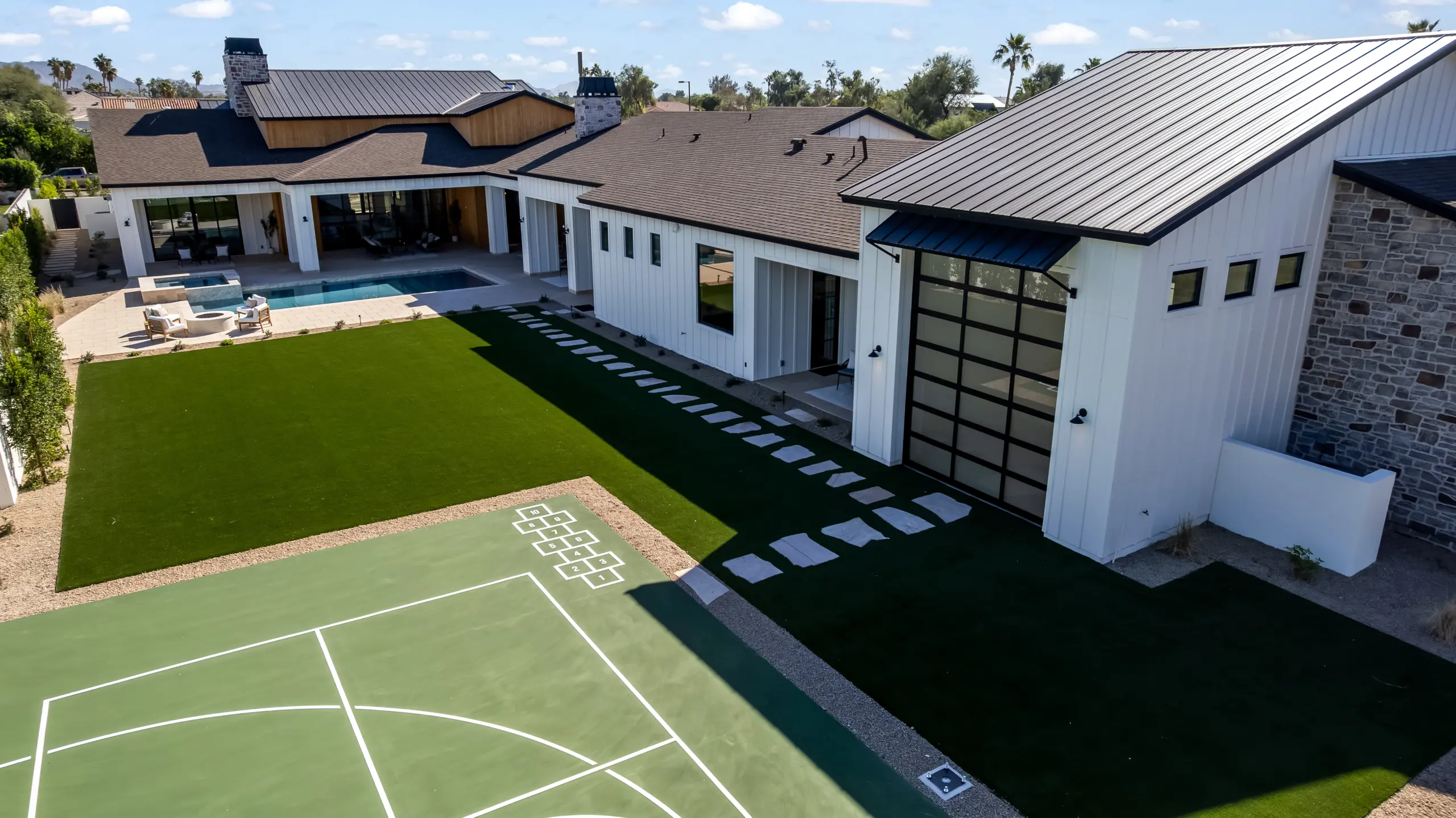
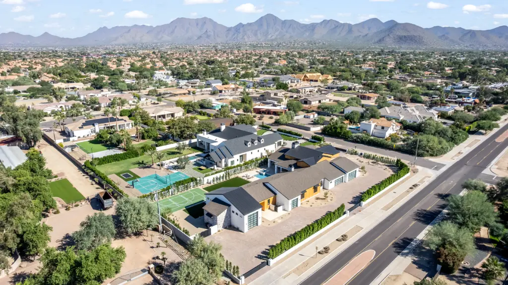
It shows the true size and shape of the lot and where the boundaries actually fall, which matters enormously for larger parcels. It shows the setting, the mountains, the desert, the neighborhood, and how the home relates to all of it. It reveals outdoor features that ground shots flatten or miss entirely, like the full backyard, the pool, the patio, and the landscaping seen from above. And it shows proximity, how close the property is to a golf course, a park, a trailhead, or open desert. For many Phoenix homes, those surroundings are half the reason someone buys, and only aerial views put them on display.
Why aerial is almost essential for Phoenix properties
This is where the local market makes the case on its own. A lot of what makes Phoenix-area real estate desirable is best seen from the air.
Large desert lots and acreage are common here, and their scale simply does not register in a ground photo. Mountain backdrops, with homes framed against Camelback, the McDowells, or South Mountain, become a powerful image only from above. Horse properties in areas like Cave Creek and North Scottsdale, golf course communities, and sprawling master-planned neighborhoods all have layouts and amenities that aerial captures in a way nothing on the ground can. And the backyard desert oasis, the pool, spa, and outdoor living that so many buyers want, looks its absolute best in a top-down or angled aerial shot. If a Phoenix property’s strongest selling points are outside the walls, aerial is how you sell them.
The numbers behind real estate drone photography
The case is not just visual. The performance data is consistent across the industry.
Listings with aerial imagery have been found to sell around 68% faster than comparable listings without it, according to figures reported by the National Association of Realtors. Aerials are also linked to a meaningful lift in in-person showings and, in some studies, a sale price premium of up to around 10% for properties where the setting drives value. There is a perception angle too. Eye-tracking research on online home shoppers found that buyers spend the most time on the very first exterior photo, lingering on it before scanning the rest. That makes a striking aerial hero shot one of the most valuable images in your entire gallery, because it earns those critical first seconds of attention and pulls buyers into the listing.
The aerial shots that actually sell a home
Not every drone photo is equal. A strong real estate aerial photography set is built from a few specific, purposeful shots, not random sky views.
The context shot is the high, wide view that shows the home, the lot, and the surrounding area, the lay of the land. The hero or oblique shot is an angled view that frames the house against its best backdrop, a mountain or a sunset, and it often becomes the listing’s headline image. The amenity shot comes down lower or overhead to feature the pool, the patio, or the outdoor living space. And the twilight aerial, captured at dusk with the home lit and the desert sky glowing, is one of the most powerful images you can produce for a Phoenix listing. A good operator plans these shots around the property’s specific strengths instead of just sending the drone up and hoping.
Timing matters, especially in the desert
Here is a local detail that separates someone who knows Phoenix from a visiting operator. When you fly matters as much as how you fly.
The best aerial light is the golden hour, shortly after sunrise or before sunset, when the desert glows warm and shadows are soft. In a Phoenix summer, midday heat creates visible shimmer and haze that can degrade aerial shots, which is another reason early morning flights win. Monsoon season brings dramatic skies but also dust and sudden wind that ground a shoot. Clear, calm conditions produce the sharpest results. A local aerial photographer plans the flight around all of this, which is part of why the images come back looking professional rather than washed out.
A quick word on doing it legally
Aerial work for a listing is commercial drone flight, and that comes with real rules. Any drone work done to market a property requires a pilot holding an FAA Part 107 certificate, a drone that broadcasts remote ID, and airspace authorization in controlled zones. This matters in Phoenix, AZ, where much of the metro sits under controlled airspace tied to Sky Harbor and other airfields, so a licensed pilot pulls the proper authorizations before flying. Hiring a certified, insured operator keeps your listing’s marketing clean and your seller protected. It is worth confirming up front.
Choosing real estate aerial services in Phoenix, AZ
When you are hiring property drone services for a listing, a few things are worth checking before you book:
Look at a real portfolio of property aerials, ideally Phoenix-area homes similar to yours, so you know they can handle desert light and the property type. Confirm the pilot holds an FAA Part 107 certificate and carries insurance. Ask whether they shoot the specific shots you want, like twilight aerials and amenity shots. Check turnaround, since a next-day delivery can get your listing live sooner. And ask whether they also offer ground photography, video, and 3D tours, so you can get a complete package from one visit.
If you want a local team that covers all of that, that is what we do. You can see options and book our real estate drone aerial services in Phoenix, AZ page.
Frequently asked questions
Do aerial photos really help homes sell faster?
Yes. Figures reported by the National Association of Realtors found listings with aerial imagery sold around 68% faster than those without. Aerials are especially effective for properties where lot size, views, or outdoor amenities are key selling points, which describes a lot of Phoenix homes.
Which properties benefit most from drone photography?
Homes with large lots or acreage, mountain or scenic views, pools and outdoor living, horse properties, and homes near golf courses, parks, or open desert. Wherever the surroundings add value, aerial helps the most.
Do I need a licensed pilot for real estate drone photography?
Yes. Marketing a property with drone imagery is commercial use, which requires an FAA Part 107-certified pilot, Remote ID, and airspace authorization where needed. In much of the Phoenix metro, that authorization is required, so hiring a licensed operator matters.
When is the best time to shoot aerials in Phoenix, AZ?
The golden hour around sunrise or sunset gives the best light, and early flights avoid the heat shimmer and haze of a Phoenix summer afternoon. Clear, calm days produce the sharpest images.
Show Phoenix buyers everything, not just the front door
In a market where the land, the views, and the setting carry so much of a property’s value, the listings that show all of it from above are the ones that move. Professional aerial photography, paired with great ground photos, gives your Phoenix listing that edge. Real Estate Photographers LLC provides real estate drone and aerial photography across Phoenix, from context and hero shots to twilight aerials, alongside photography, video, and 3D tours. See our real estate drone aerial services in Phoenix, AZ, or call +1 928 710 1646 to book.